Tank: A Complete Guide
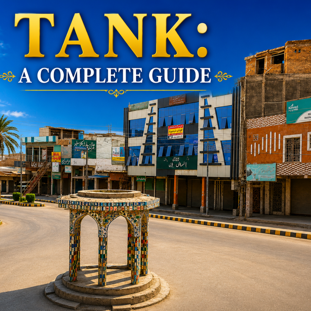
Tank is the frontier trading town at the mouth of the Gomal Pass. This old town rests where the plains meet the Sulaiman hills. A great river the Gomal, waters its fields from the Afghan border. A walled town of the Nawabs once rose here. Bazaars and shrines mark its Pashtun heritage. This guide covers Tank for the curious traveller. It explains the setting the history the river the culture and how to visit.
This guide offers a general overview. Details and figures vary between sources.
Quick answer: Tank is a town and district in the south of Khyber Pakhtunkhwa, set where the plains meet the Sulaiman hills. It rests some 70 kilometres north west of Dera Ismail Khan. It is set at the mouth of the historic Gomal Pass a long trade route linking Afghanistan to the plains. Once ruled by the Nawabs of Tank, it grew as a walled trading town. Farming and trade drive its economy, watered by the Gomal River. Spring and autumn are the finest seasons.
About Tank
Tank is a town in the south of Khyber Pakhtunkhwa. It is located where the plains meet the Sulaiman hills. Dera Ismail Khan rises to the south east. A highway links the two towns.
A great pass shaped the fortunes of the town. Tank rests at the mouth of the Gomal Pass. This old route runs west into Afghanistan. Caravans long passed through on the way to Ghazni.
A varied country blends plain and hill. Flat farmland spreads to the east. Rugged hills rise towards the west. This mix of land marks the area.
Farming and trade fill daily life. Wheat, barley and maize grow in the fields. Markets gather the produce of the country. Tank has long served as a trading town.
History of Tank
Tank carries a long frontier story. Trade routes crossed here in ancient times. Many peoples passed through over the ages. Deep history rests across the country.
A ruling family shaped the town. A line of Nawabs held sway of old. Katal Khan founded the walled town. His mud fort once guarded the streets.
A strong wall ringed the old town. Seven gates opened through the defences. Corner pickets housed armed guards. This layout marked a frontier trading place.
British rule reshaped the district in time. A ruling power then faded away. Tank became a tehsil of Dera Ismail Khan. It grew into a district of its own in later years.
Gomal River and the pass
A great river shapes the whole district. Gomal waters rise in the hills of Afghanistan. It flows in through the Waziristan country. Its waters reach the plains of Tank.
A famous pass follows the river valley. This famous route links Afghanistan to the plains. Traders long drove their caravans through it. Ghazni lay at its far western end.
Great works now tame the river. A dam at Gomal Zam rises upstream in the hills. Its canals water the dry land of Tank. Power flows from the dam as well.
An old system spreads the water. Its Zam channels carry it across the land. Barren fields turn green with its flow. This irrigation feeds the farms of the district.
Culture and attractions in Tank
Tank is a proud Pashtun clan. The tribes of the region maintain their ancient traditions. Each visitor is treated with courtesy and hospitality. Culture influences the lifestyle of the entire nation.
The bazaars are located in the center of the city. The traders sell all kinds of goods, such as fruits, cattle, and other handcrafted items.
Shrines draw the faithful and the curious. A famous shrine of Pir Sabir Shah Baba rises here. Devotees gather for its yearly celebration. Another shrine rests near Umar Adda.
Old sites dot the country around. Kot Allahdad holds an archaeological mound. A British scholar once studied these ruins. History lingers across the plains.
Visiting Tank
Come in spring or autumn. Summers grow fiercely hot on the plains. Winters turn cool and pleasant. Cooler seasons suit a visit best.
Reach the town by road. A highway links it to Dera Ismail Khan. Roads run on towards Zhob and beyond. A railway once served the town too.
See the bazaars and shrines. Old markets brim with local goods. A shrine of Pir Sabir Shah draws many visitors. A morning walk takes in the old town.
Enjoy the country nearby. A great dam waters the fields around. Old mounds reward the keen traveller. Bring time for both history and scenery.
Frequently asked questions
Where is Tank? Tank is a town and district in the south of Khyber Pakhtunkhwa, set where the plains meet the rugged Sulaiman hills. It is set about 70 kilometres north west of Dera Ismail Khan, to which a highway links it. Tank borders the districts of Lakki Marwat, Dera Ismail Khan and South Waziristan. This town is set at the mouth of the plains of the historic Gomal Pass a long used trade route running west into Afghanistan. This position, between the farmland of the plains and the hills of the frontier, has long made Tank a trading centre for the surrounding country.
What is the history of Tank? Tank has a long history as a frontier trading town, shaped by its position on the routes between Afghanistan and the plains. In the past it was ruled by the Nawabs of Tank. A walled town was founded by Katal Khan the first Nawab, who built a protected town with a surrounding wall, seven gates and a mud fort guarded by corner pickets. Under British rule the power of the Nawabs faded. Tank became a tehsil of Dera Ismail Khan, before growing into a district of its own in later years. This layered past reflects its role as a frontier crossroads.
What is the Gomal River? A great river of the Tank district the Gomal rises in the hills of Afghanistan. It flows through the Waziristan country before reaching the plains of Tank and joining the Indus near Dera Ismail Khan. Its long course, of around four hundred kilometres, has long carried both water and trade between Afghanistan and the plains. Today the river is tamed by the Gomal Zam Dam, built upstream where it passes through a narrow ravine. This dam stores water for irrigation and generates power. Canals from the dam bring water to the dry land of Tank, turning barren fields green.
What is Tank known for? Tank is known above all as a trading and farming town, serving as a hub for the agricultural produce, livestock and crafts of the surrounding Pashtun country. Its fertile plains, watered by the Gomal River, produce wheat, barley and maize, while its bazaars gather goods from the villages and hills around. This town is also known for its handloom weaving of tribal cloth along with small industries such as flour milling and oil extraction. Its position at the mouth of the Gomal Pass has long given it importance as a frontier trading centre.
When is the best time to visit Tank? A best time to visit Tank is in spring from around February to March. Autumn from October to November, is also mild and comfortable. Summers on the plains can be very hot with high temperatures that make the middle of the day tiring, while winters are generally cool and pleasant. Cooler months suit sightseeing at the bazaars, shrines and the country around the town. Those keen to see the farmland at its greenest may wish to visit in spring, when the fields watered by the Gomal are fresh and full.
Gateway of the Gomal
Tank is the frontier gateway of the Gomal Pass. This old town rests where the plains meet the hills. A great river the Gomal, waters its fields from the Afghan border. A walled town of the Nawabs once rose here. Bazaars and shrines mark its Pashtun heritage. Few towns hold such a crossroads place on the frontier.
You may come to Tank for the history the bazaars or the river. This town rewards the visit either way. You can trace the line of the old walled town. You can wander the busy bazaars of the frontier. You can follow the Gomal towards the famous pass. Come to Tank and discover the gateway of the Gomal. This is the trading town of the south.